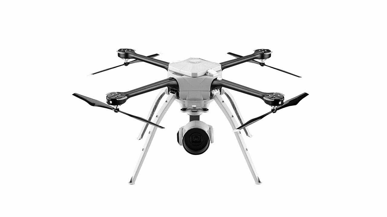
Skyranger

Unmanned Aerial Vehicles (UAVs) or Air Drones
Air units designed for monitoring and reviewing extensive outdoor areas, which allow us to design intelligence monitoring strategies, wherever, whenever and under any weather condition
Characteristics
presentation Skyranger
Data sheet
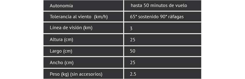
Data sheet
Ease of Operation Skyranger
Touch screen operation allows intuitive abilities if using Camera Control Yostick. and breadcrumb tapping the touch-screen system dynamic flight control system includes folow-me function and charging system maps revisar area funcionales advanced communication features and ópticos image stabilization system sends dual stream color video and IR, simultaneously, in high resolution system formatoH264 1080P color, and pictures de to 15MP; IR formatoH264 640X480 format, in black hottest white spots and less calientes Low delay in sending signals and video thanks to its encryption system 256 bits line of sight capability of up to 3 km,
Advantages of Unmanned Units Aereas
allows us to visualize situations and seeking recognition allows us blancos. monitoring a security perimeter amplio intelligent coverage that allows us to recognize and vigilancia. us to detect acts of piracy in embarcaciones Get information and respond in cases of desastre Coordinate and display in case of use of chemical or radioactive
Virtual Building Scene
Security departments, research, emergencies and traffic can use images and aerial data to create 3D models of buildings, streets and entire neighborhoods. These scenes allow virtual teams to plan and execute tactical operations during shootouts, barricades or making terrorists, hostages, as well as cases of bombs and / or threats.
Evidence collection and Intelligence
Aerial images of high resolution Aeryon UAVs are integrated into a traditional photogrammetry software that provides accurate and detailed information. Their combined with a secure digital transmission network advanced optical systems enable the group to capture intelligence data on the site instantly and act before a crime, accident or disaster compromise the first interventions.
Recognition, Search and Surveillance
An aerial perspective allows officers through obstacles, trees and places to have adequate knowledge of the situation. Aeryon platform is suitable for collecting images RVA / Infrared simultaneously and provides flexibility to transmit multiple videos to officers or command centers regardless of their geographic location.